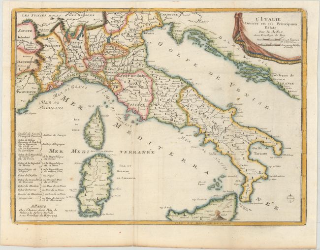
Subject: Italy
Period: 1705 (dated)
Publication: Petit et Nouveau Atlas
Color: Hand Color
Size:
10.9 x 8.1 inches
27.7 x 20.6 cm
This small map of Italy with its neighboring countries also includes good detail of the islands of Corsica, Sardinia, and part of Sicily with a flaming Mt. Etna. The map extends from Provence, France and Lake Geneva in the west to the Dalmatian coastline. At lower left is a table identifying the rulers of the various states and duchies.
References: Pastoureau, FER XII A [18].
Condition: A
A crisp impression, issued folding on paper with a bunch of grapes watermark and a binding trim at left that has been professionally replaced with old paper. There is a tiny hole that has been professionally repaired and a small adjacent rust spot just west of Sardinia.