Subject: Northern Spain
Period: 1680 (circa)
Publication:
Color: Hand Color
Size:
19.1 x 14.9 inches
48.5 x 37.8 cm
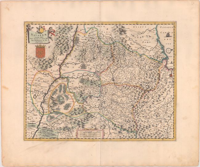
This elegantly engraved map covers the Navarre region in Spain. The map centers on Pamplona and extends as far north as the Bay of Biscay and as far south as Tarazona. There is good topographical detail showing rivers, forests, and mountains. San Adrian tunnel, an important milestone on the Basque route of the Way of St. James, is prominently depicted. The north is oriented to the right. There are two cartouches, one at top left containing the title that is held aloft by putti, and another at bottom enclosing three distance scales. The coat-of-arms of Navarre appears beneath the title cartouche.
References:
Condition: B+
A fine impression with contemporary color, light offsetting, a couple tiny rust spots, and marginal toning. There is a centerfold separation that enters 0.5" into the neatline at bottom that has been closed on verso with archival materials.