Subject: Southwestern Netherlands
Period: 1637 (published)
Publication: Appendix Atlantis
Color: Hand Color
Size:
19.6 x 15.1 inches
49.8 x 38.4 cm
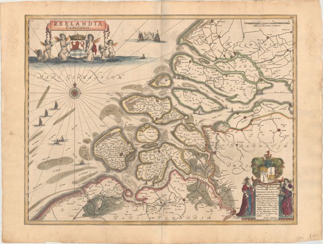
This lovely map of the Province of Zeeland, with its many islands and peninsulas, is filled with information on major cities, small villages, and natural features. Development over time has changed the topography considerably from the 17th century. The North Sea features merfolk holding a banner with the title and the coat of arms of the region, a nice compass rose, rhumb lines, and numerous ships, two of them engaged in a battle. Latin text on verso, published in 1637.
References: Van der Krogt (Vol. I) #3600:1B.1.
Condition: B+
There is light printer's ink residue at right, minor soiling, and toning along the edges of the sheet. The map has been trimmed to the neatlines and pasted onto a larger sheet of old paper, thereby covering up the text on verso. There is an old manuscript page number on verso that shows through into the map at top left.