Catalog Archive
Auction 172, Lot 43

"A Map of the North Pole with All the Territories That Lye Near It, Known to Us &c...", Moll, Herman
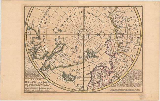
Subject: North Pole

Period: 1729 (published)

Publication: Atlas Minor

Color: Hand Color

Size:
10.8 x 8 inches
27.4 x 20.3 cm
Download High Resolution Image
(or just click on image to launch the Zoom viewer)

This unusual map depicts the North Pole and shows incomplete northern coastlines for North America and Greenland. Novaya Zemlya is correctly shown as an island facilitating a Northeast Passage to Asia. Above the Pole is Parts Unknown, and three compass roses complete the composition. This is the second state of the map, which includes the number "2" at top right and the Bowles imprint at lower right.

References: Kershaw #408; Shirley (BL Atlases) T.MOLL-9a #61.

Condition: B+

Original outline color on a watermarked sheet with light toning and two tiny holes only visible when held to light that have been closed on verso with archival tape.

Estimate: $200 - $230

Sold for: $150

Closed on 4/17/2019

Archived