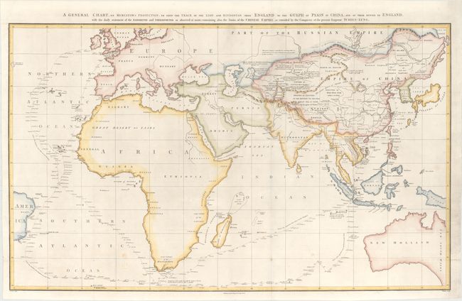
Subject: Eastern Hemisphere
Period: 1796 (dated)
Publication: An Authentic Account of an Embassy from the King of Great Britain…
Color: Hand Color
Size:
36.7 x 22.3 inches
93.2 x 56.6 cm
This large chart was part of an account of George Macartney's travels to China. Macartney was Britain's first envoy to China, and was tasked with convincing emperor Emperor Qianlong to ease restrictions on trade between Great Britain and China by allowing the British to have a permanent embassy in the country.
The map shows the track of two ships, the Lion and Hindostan, on their routes from England to China and back. Each day's progress was recorded along the route along with several notations to the dangers along the way. The map was drawn by John Barrow, who was the private secretary to Lord Macartney. He was later Secretary to the Admiralty and was a vice-president and founding member of the Royal Geographical Society. Engraved by B. Baker and published by George Nicol.
References: Shirley (BL Atlases) G.BARR-1a #1.
Condition: A
An excellent impression, issued folding on a bright sheet with a "J. Whatman 1794" watermark. There are a few small, unobtrusive spots of soiling near the bottom of the image.