Catalog Archive
Auction 172, Lot 392

"A New Encreasing Compass Map of Part of the East-Coast of England... / Nieuwe Wassende Gradige Pas-kaart van een Gedeelte der Oost Kust van Engeland...", Keulen, Gerard van

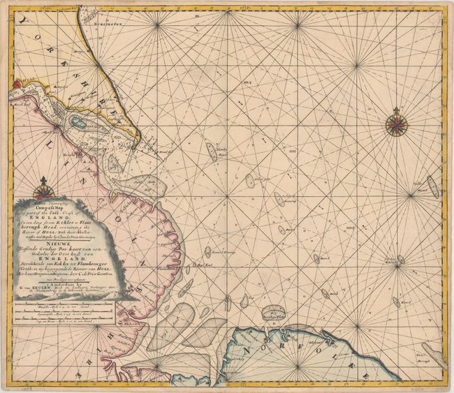
Subject: Northern England

Period: 1730 (circa)

Publication: De Nieuwe Groote Lichtende Zee-Fakkel...

Color: Hand Color

Size:
23.4 x 20.3 inches
59.4 x 51.6 cm
Download High Resolution Image
(or just click on image to launch the Zoom viewer)

This beautifully engraved chart covers the northeastern coast of England from Bridlington south to Hull, Grimsby, Boston and Cromer. The Hull River estuary is prominently shown with numerous soundings, anchorages, shoals, and rhumb lines filling the waters. The map is adorned by two compass roses with fleur-de-lis and a decorative title cartouche with a profile view at bottom. Dual titles in English and Dutch.

References: Shirley (BL Atlases) M.KEU-2k #34.

Condition: B+

On double-thick watermarked paper with a few faint spots and some minor printer's ink residue. There are two repaired edge tears that just enter the border.

Estimate: $350 - $425

Unsold

Closed on 4/17/2019

Archived