Catalog Archive
Auction 172, Lot 367

"A Chart of the Straights of Magellan, in Which Are Inserted the Observations and Discoveries, of Captn. Byron, Captn. Wallis and Captain Carteret", Russell, John C.

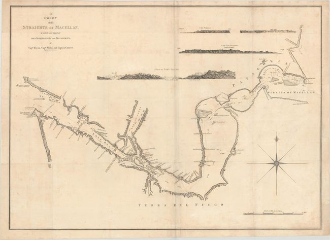
Subject: Strait of Magellan

Period: 1768 (circa)

Publication:

Color: Black & White

Size:
31 x 22.3 inches
78.7 x 56.6 cm
Download High Resolution Image
(or just click on image to launch the Zoom viewer)

Striking large-scale chart showing the Straits of Magellan and the Patagonian coast with detailed shoreline topography. Channels, soundings, shoals, harbors, islands and anchorages are all detailed. Four finely engraved views are incorporated at top: Cape Virgins; White Cliffs; Cape Fair Weather; and A View of Port Famine (Puerto Hambre). The chart includes a large compass rose and depicts the discoveries of the British navigators, Byron, Wallis and Carteret.

References:

Condition: B+

A good impression on a sheet with folds as issued. There is light soiling and faint foxing. A binding trim at right has been replaced with old paper, and an adjacent binding tear that enters about 1.5" into map has been archivally repaired. Tissue reinforcements are present on some of the folds on the verso.

Estimate: $275 - $350

Sold for: $150

Closed on 4/17/2019

Archived