Subject: Guyana, Suriname, French Guiana
Period: 1876 (dated)
Publication:
Color: Black & White
Size:
31.4 x 25.3 inches
79.8 x 64.3 cm
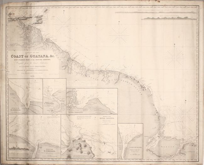
This blueback chart extends from the Orinoco River to the Amazon River. There is excellent detail of the coastline, particularly of the rivers and inlets, which are also featured in six large insets of the entrances to the Orinoco, Berbice, Surinam, Cayenne, Demerara, and Corentin Rivers. Soundings, rocks, shoals, and lighthouses are also shown. At top right are two land approach views. The chart is based on the work of J. S. Hobbs and published by Charles Wilson (formerly J. W. Norie & Wilson).
References:
Condition: B
This working chart is in good condition considering its heavy use, with moderate soiling and a few pencil notations. There are a couple of minor tears and chips along the edges of the sheet, including one that enters about 1/2" into the image at left, and some creases at far right that appear to have been caused during the gluing of the chart onto the blue paper backing.