Subject: Jamaica
Period: 1816 (circa)
Publication: New General Atlas
Color: Hand Color
Size:
23.6 x 16.8 inches
59.9 x 42.7 cm
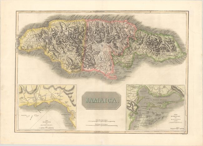
This great large chart of the island of Jamaica features two insets, The Harbour of Bluefields and The Harbours of Kingston and Port Royal. The map is based on Jefferys' map of 1775. It is filled with detail of roads and towns, including Trelawny Town and Accompong Town, both important in Jamaica's Maroon history. Thomson's publishing business prospered between 1813 and 1869. His maps are noted for their accuracy, strong impression and fine engraving. Engraved by T. Clerk.
References: Kapp (MCC-42) #145.
Condition: A
Contemporary color on a bright sheet of sturdy paper with an "1811" watermark and very minor soiling. There are two tiny worm tracks in the bottom blank margin.