Subject: Greater Antilles
Period: 1843 (dated)
Publication:
Color: Black & White
Size:
34.6 x 23.3 inches
87.9 x 59.2 cm
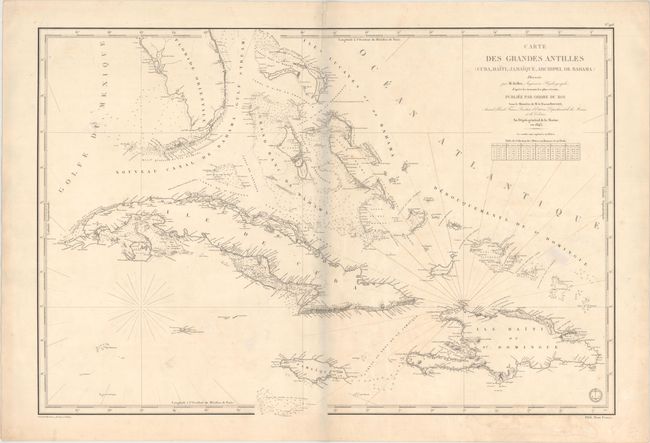
Magnificent, detailed sea chart of the southern tip of Florida, Cuba, Jamaica, Hispaniola, Puerto Rico, and the Bahamas. The coastlines are filled with soundings, rocks, shoals, and place names. Prepared by M. Keller under the direction of M. le Baron Roussin. Drawn by J. M. Hacq. and engraved by Chassant. The engraved seal of the Depot de la Marine and Prix Deux Francs are at bottom right.
References:
Condition: B+
A nice impression on sturdy paper with very light soiling and an archivally repaired tear that enters 2" into map at top center. Rhumb lines have been added in old manuscript ink. There is a grayish shadow along the centerfold that is caused by our scanner and doesn't appear on the map itself.