Subject: Southwestern United States & Mexico
Period: 1814 (dated)
Publication: New General Atlas
Color: Hand Color
Size:
24.4 x 20 inches
62 x 50.8 cm
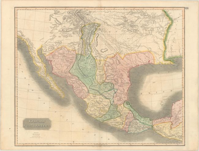
The Spanish possessions in North America are the focus of this large, significant map. Especially noteworthy is the delineation of the great western river systems - particularly the Platte flowing east and south of the Rocky Mountains. The conflict between the United States and Spain at the beginning of the 19th century is vividly illustrated on this map. Spanish control of the southwest region is limited to part of Texas and a strip of land in present day New Mexico that includes Santa Fe and Albuquerque. East of that is a huge Louisiana Territory, and the country to the west is unnamed and largely Unknown Parts. A city named Texas appears near present-day Austin, within the province of St. Louis de Potosi, which is also labeled New Santander. In this edition, Pikes Peak is not named but is labeled as the Highest Peak. According to Wheat, the map originated primarily from the epic Humboldt and Pike maps and to some extent the Pinkerton and Arrowsmith maps published a few years earlier. This very handsome map names many Indian tribes and villages, with terrific early information on topography and watershed.
References: Wheat (TMW) #320.
Condition: B+
Contemporary color on paper with a "1794" watermark, light offsetting, and minor creasing along the top edge of the sheet.