Subject: Southern United States & Mexico
Period: 1841 (dated)
Publication: Stielers Hand Atlas
Color: Hand Color
Size:
15 x 12.1 inches
38.1 x 30.7 cm
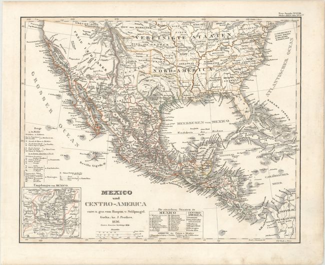
Handsome and finely engraved map that includes portions of central, southern and western America. Texas is shown as an independent Republic with its northern boundary along the Red River and its southern border along the Nueces River. Neu Mexico is an interesting shape extending north into present-day Colorado with a narrow strip of land that extends to Bighorn Mountains in present-day Wyoming. Several territories are identified in the United States, including Ozark, Osage, Sioux, Mandan, and Oregon. Neu Californien is well detailed and shows numerous coastal cities and missions including S. Diego, S. Juan [Capistrano], San Carlos del Monterey, and San Francisco. The remainder of the Southwest is labeled Freie Indianer (Free Indians). An inset of Mexico City and its lakes is at lower left. Tables list the states of each region. Drawn by Von Stulpnagel.
References:
Condition: A
Contemporary outline color on a bright sheet with light soiling mainly confined to the blank margin at bottom right.