Subject: Southern United States & Mexico
Period: 1574 (published)
Publication: La Geografia di Claudio Tolomeo Alessandrino
Color: Hand Color
Size:
9.6 x 7.1 inches
24.4 x 18 cm
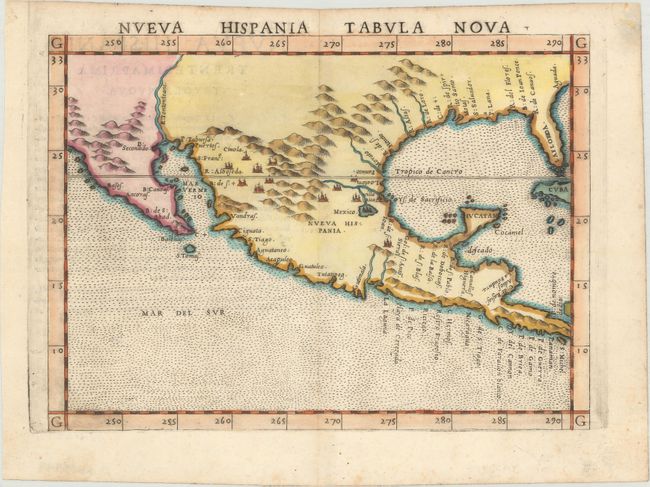
This is a foundation map in the cartography of the American Southwest, and a must for collectors of that region. It is an enlarged version of Gastaldi's map of 1548 with the only notable change being the peninsular Yucatan. The legendary seven cities of Ciuola are prominently depicted and Mexico City is shown floating in a large lake. The place names along the upper Gulf Coast reveal the explorations of Pineda, Cabeza de Vaca and Moscosso. The Mississippi makes its appearance as the Rio de Spiritu Santo and the R. Tontonteanc flows in the vicinity of the Colorado River. Considered the earliest relatively obtainable map of Mexico and the American Southwest. This is the second state of the map according to Burden, with the plate mark running off the top of the page. Italian text on verso.
References: Burden #31; Martin & Martin, plt. 3; Wheat (TMW) #7; Mickwitz & Miekkavaara #220-60; Shirley (BL Atlases) T.PTOL-10e.
Condition: A
A nice impression on a bright sheet with minor toning and foxing confined to the blank margins.