Subject: Richmond, Virginia, Civil War
Period: 1864 (published)
Publication:
Color: Black & White
Size:
14.1 x 16.3 inches
35.8 x 41.4 cm
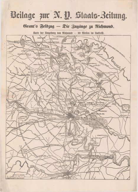
This rare broadside was published for a German audience during General Grant's Overland Campaign of 1864. Centered on Richmond, the map covers an area from just north of Hanover to Petersburg in the south with concentric circles indicating distance from the city center. Relevant details include railroads, wagon roads, rivers and creeks, and several notations regarding Sheridan's position as his Union regimen pursued Lee's forces. The Overland Campaign lasted for two bloody months through central Virginia. While Union losses were significant, Confederate casualties were proportionally much higher, allowing General Grant to eventually take control of Richmond.
Other that the German title, this map appears to be identical to the one published as a supplement to the June 1, 1864 issue of the New York Times.
References:
Condition: B+
Issued on thin paper with some extraneous creases from having been previously folded that are now reinforced on verso with archival tape. There are a few tiny holes along the left border that are only visible when held to light.