Subject: Eastern Virginia
Period: 1928 (circa)
Publication:
Color: Printed Color
Size:
22.7 x 16.9 inches
57.7 x 42.9 cm
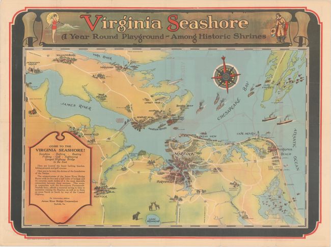
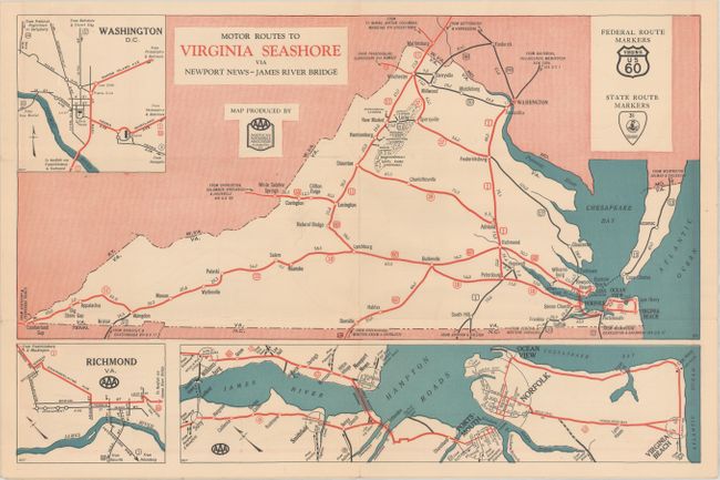
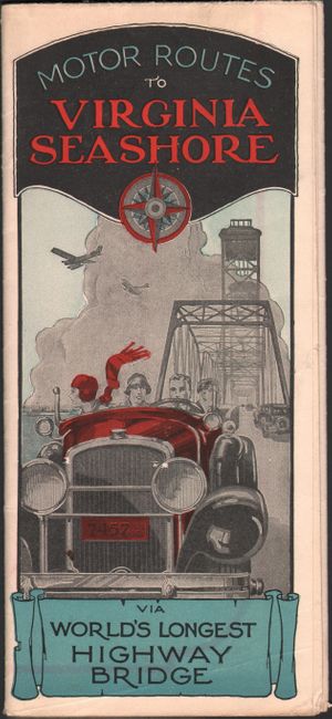
This promotional map of eastern Virginia covers the region from Jamestown and Williamsburg east to Cape Charles and Virginia Beach. It was published in conjunction with the opening of the James River Bridge, connecting Newport News with Isle of Wight County (now Route 17). This 5 mile bridge was touted as the longest bridge in the world at the time, and allowed for easier access to Virginia Beach and other coastal communities. The verso contains a state map, several insets, and photo illustrations. Published by the James River Bridge Corporation.
References:
Condition: B+
Issued folding with a few small fold separations and light show-through from map on verso.