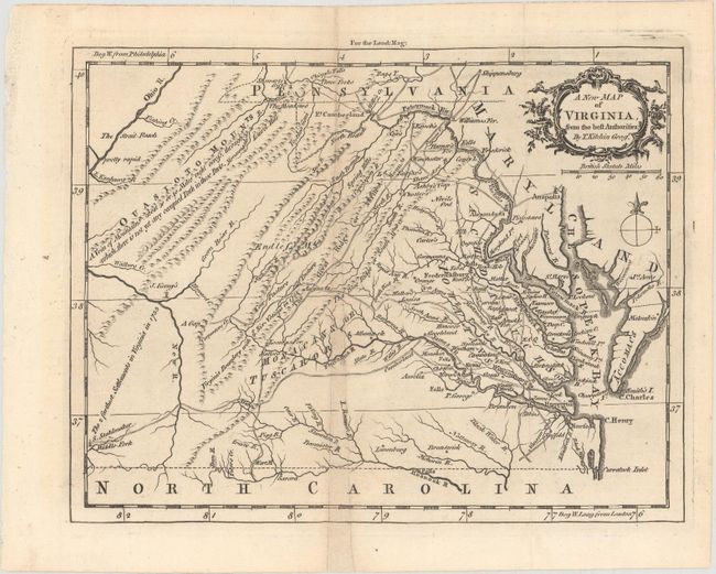
Subject: Colonial Virginia
Period: 1761 (published)
Publication: London Magazine
Color: Black & White
Size:
9.1 x 7 inches
23.1 x 17.8 cm
This uncommon map of colonial Virginia is filled with detail of early towns, roads, rivers, waterfalls, ferry crossings, Indian boundaries and interesting notations. On the Middle Fork of the Holston River is the farm of S. Stahlmaker and at the junction of the Greenbrier and New River is the homestead of J. Keeny's. These are described as "the farthest settlements in Virginia in 1755." The title is contained in a decorative cartouche above the distance scale. Published in the November 1761 issue of London Magazine.
References: Jolly #LOND-205; Sellers & Van Ee #1436.
Condition: B
A dark impression on a mostly clean sheet, issued folding. There is a narrow section near the middle of the map (0.25" at its largest extent at bottom) that has been replaced with old paper with a small amount of image in facsimile.