Subject: Vermont
Period: 1795 (circa)
Publication:
Color: Hand Color
Size:
11.9 x 14.9 inches
30.2 x 37.8 cm
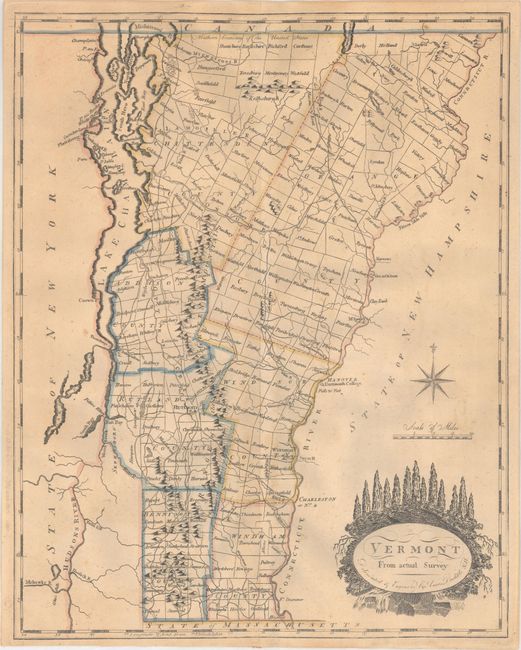
Attractive, early map of Vermont divided into seven counties with townships shown and named. The major towns, Dartmouth College and a fairly extensive road network is delineated. Amos Doolittle was a New Hampshire cartographer and engraver, who produced many of the best early maps of New England. This map of Vermont is a fine example of his work.
This map appeared in Carey's American Edition of Guthrie's Geography Improved in 1795 and Carey's General Atlas between 1800-14. According to Wheat & Brun, Carey advertised a map of Vermont for sale in the (Philadelphia) Gazette of the United States, May 8, 1794; a copy of which has not been located. They speculate that it may have been a prior publication of this map. This example does not match either of the states they note as there is no imprint or page number above the top neatline and no additional neatline surrounding the map.
References: Wheat & Brun #195.
Condition: B+
Original outline color with light toning and a 2" centerfold separation at bottom. There is a tiny hole in the decorative title cartouche only visible when held to light.