Subject: Charleston, South Carolina
Period: 1884 (dated)
Publication:
Color: Black & White
Size:
26.2 x 27.3 inches
66.5 x 69.3 cm
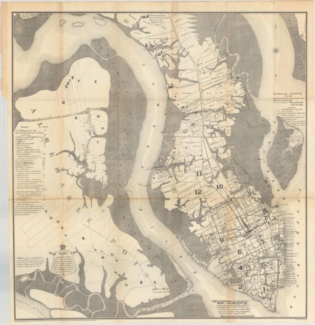
This historical map of Charleston is by Louis J. Barbot, the city's civil engineer, and was published to accompany Mayor William Courtenay's Centennial Address on August 13, 1883. The map chronicles the city's evolution, showing the original settlement at Albemarle Point, established in 1670, and the Oyster Point settlement, established two years later, in addition to the subsequent developments. It depicts the city in plan form, with excellent detail of streets, wharves, railroads, fortifications, properties, and more. Additional sites of interest include the Liberty Tree, "Lands of Confederate Lines," "Site of Fort of the War of 1812," race courses, and phosphate works. A key at left identifies colonial land plots at the original Albemarle Point settlement, listing owners and the amount of acreage they were allotted. There is an alternate title: Historical Map of Charleston 1670-1883.
References: Phillips (Maps) p. 219.
Condition: B+
Issued folding with some light toning and foxing along the folds and some short splits at fold intersections.