Subject: South Carolina
Period: 1825 (dated)
Publication: Atlas von America
Color: Hand Color
Size:
14.6 x 12.8 inches
37.1 x 32.5 cm
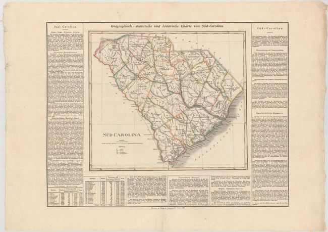
This attractive map, based on the important first official map of South Carolina by John Wilson in 1822, provides a detailed view of the counties, roads, and settlements. This map is surrounded by German text describing the great state, with the title above "Geographisch - Statistische und Historische Charte von Sud-Carolina." Similar to Carey & Lea's map of South Carolina from their Atlas of North America, this rare German edition was re-engraved by the Weimar Geographischen Insitut for Weiland's Atlas, and is one of the earliest maps of the state printed outside the U.S. The full sheet with German text measures 22.3 x 16.9".
References:
Condition: A
Wide margins with contemporary outline color and archival repairs to a 1/2" horizontal tear in Lexington county and a short centerfold separation in the bottom blank margin.