Subject: Pittsburgh, Pennsylvania
Period: 1930 (dated)
Publication:
Color: Printed Color
Size:
66.5 x 45.3 inches
168.9 x 115.1 cm
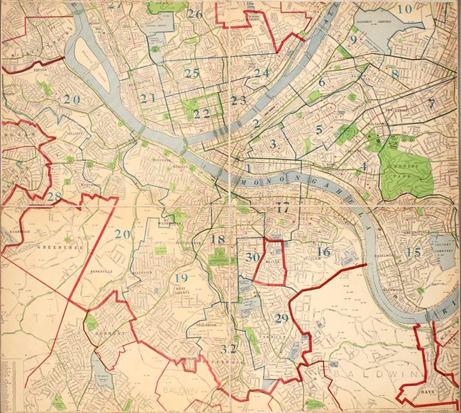
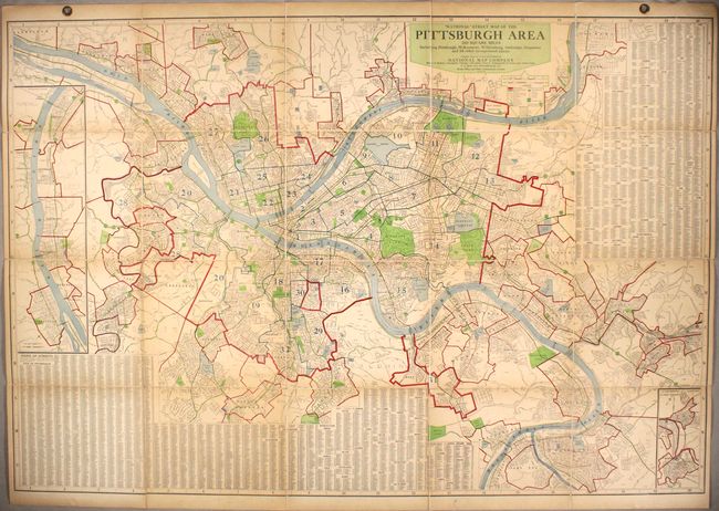
This large wall map depicts Pittsburgh and its surroundings in excellent detail. It provides a comprehensive view of the layout of the city's streets, with an extensive index locating not just Pittsburgh's streets, but also the streets of nearby cities Duquesne and McKeesport and various boroughs and townships. Parks, cemeteries, country clubs, police and fire stations, post offices, schools, the City of Pittsburgh Tuberculosis Dispensary, the University of Pittsburgh, Carnegie Mellon, and other sites of interest are identified. The courses of the Allegheny, Monongahela, and Ohio rivers are traced, with a number of bridges named (appropriately enough for the so-called "City of Bridges"). The map spills over into the suburbs, depicting as far north as West View and Oak Mount and as far south as Mt. Lebanon, McKeesport, and Port Vue. An inset at left extends the map even farther northwest to show Ambridge, Leetsdale, Edgeworth, Sewickley, and Coraopolis. A second inset at bottom right details Pitcairn and Trafford in the east. Backed in linen, as issued, with its original brass grommets.
References:
Condition: B+
There is light toning, especially concentrated along the folds.