Subject: West Point, New York
Period: 1940-42 (circa)
Publication:
Color: Printed Color
An unusual pair of West Point maps issued during World War II:
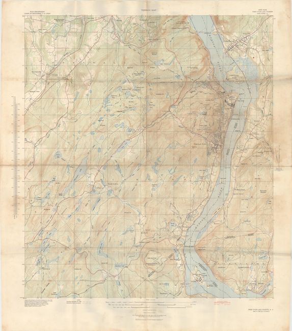
A. Terrain Map - New York West Point and Vicinity Grid Zone "A", by U.S. Corps of Engineers, dated 1942 (28.0 x 30.4"). This large-format map covers the vicinity around the Hudson River from Iona Island to Constitution Island. Shows excellent detail topography, drainage, and the U.S. Military Academy with a legend at bottom identifying both military lands and military lands to be acquired. Based upon U.S.G.S. quadrangles from 1937 and published by the Army Map Service in 1942. Condition: Issued folding with light soiling and staining from use.
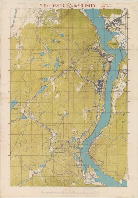
B. West Point, N.Y. & Vicinity, circa 1940 (20.3 x 29.9"). Issued on thin, banknote-style paper that appears to be based upon U.S.G.S. maps of region as well. Presents good detail of topography and development along the Hudson River. Title and scale have been added in rather crude red overprinting. Condition: Issued folding with some minor color offsetting and a short edge tear confined to the top blank margin that has been closed on verso with archival tape.
References:
Condition: B+
See description above.