Subject: Long Island, New York
Period: 1926 (dated)
Publication:
Color: Printed Color
Size:
31.6 x 8.5 inches
80.3 x 21.6 cm
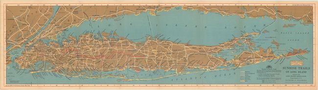
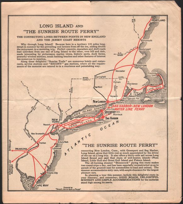
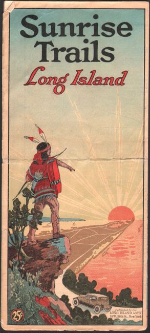
This attractive map of Long Island by White Way Maps was issued by the Long Island Association. Its key identifies highways, proposed highways, ferries, golf clubs, railroads, boat lines, and sand. In addition, the map includes place names, parks, radio towers, Camp Upton U.S. Experimental Forest Reservation, Walt Whitman's birthplace, and much more. The map extends to show Manhattan and parts of New Jersey and Connecticut. The copyright credits Redfield-Kendrick Odell Co. On verso there is copy touting Long Island's many charms and a smaller map, Long Island and "the Sunrise Route Ferry"... (7.3 x 7.9"), that spans the coast from Delaware Bay north to Portland, Maine. The striking cover illustration depicts a Native American in traditional dress pointing towards a blazing sunset as a car winds down the highway below him.
References:
Condition: B+
Issued folding with an extraneous crease that runs horizontally through the pamplet and is most notable on the cover illustration. On the map, there are small areas of show-through from text on verso, and in the margins, there is light toning and some tiny tears.