Subject: Montana
Period: 1911 (dated)
Publication:
Color: Printed Color
Size:
49.7 x 34.1 inches
126.2 x 86.6 cm
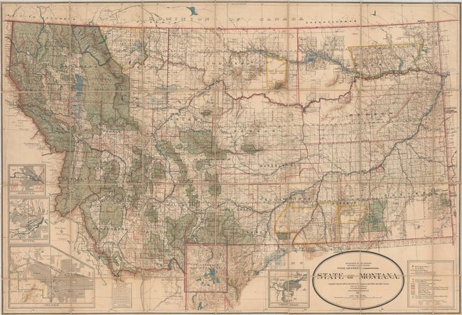
This impressive, separately issued map of the state was drawn by Daniel O'Hare under the direction of I.P. Berthrong. Drawn on a scale of 12 miles per inch, the colorful map locates numerous national forests, Indian Reservations, Military Reservations, and Yellowstone National Park. Public surveys are mostly complete but several areas in the northeast are still unsurveyed. Hydrology and topography are well developed and the growing railroad network is depicted. The extensive legend identifies land offices, Surveyor General's Office, county seats, towns, villages and more. Includes insets of Missoula, Butte, Helena, and Great Falls. The map is housed in its original G.L.O. paper envelope.
References:
Condition: B+
Dissected and backed on linen with pleasant light toning and a bit of offsetting at lower left. There is a 3" repaired tear below the Great Falls inset at bottom and a 1" repaired edge tear at left.