Catalog Archive
Auction 172, Lot 238

"Geological Map of the Lake Superior Land District in the State of Michigan", Foster/Whitney

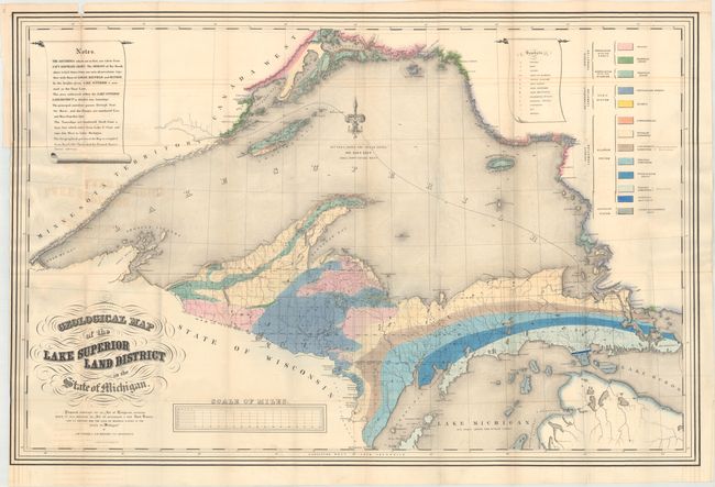
Subject: Michigan, Lake Superior

Period: 1847 (dated)

Publication:

Color: Hand Color

Size:
39 x 25.8 inches
99.1 x 65.5 cm
Download High Resolution Image
(or just click on image to launch the Zoom viewer)

A striking map that shows the geology of the Upper Michigan Peninsula, Isle Royale and the north shore of Lake Superior and indicates copper, iron, silver, marble furnaces, iron forages and active/inactive mines. A key at right identifies thirteen different geological types, and the map is centered on a beautiful fleur-de-lys.

References: Marcou & Marcou #367.

Condition: B

Issued folding with light offsetting and a short binding tear at left that has been closed on verso with archival tape. There are several short splits at fold intersections and three longer fold separations that have been closed on verso with archival tape.

Estimate: $220 - $250

Sold for: $120

Closed on 4/17/2019

Archived