Subject: Chicago, Illinois - Atlases
Period: 1919 (dated)
Publication:
Color: Black & White
Size:
25.1 x 30.3 inches
63.8 x 77 cm
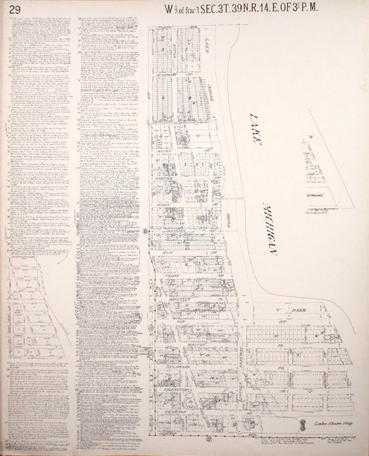
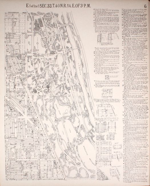
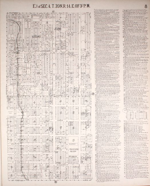
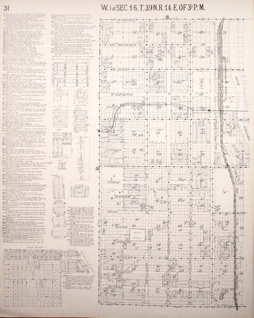
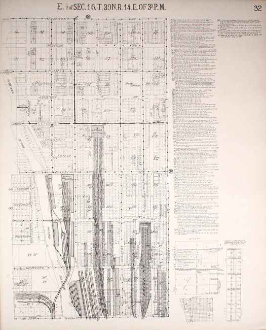
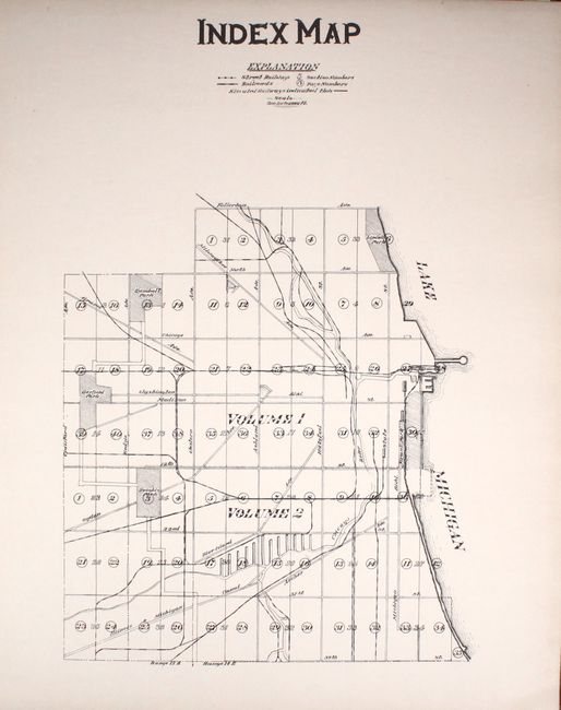
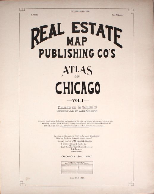
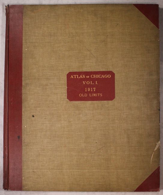
This large, elephant folio atlas is a remarkable find. Real estate, title, and insurance companies used these atlases. They were usually discarded when they became outdated and are quite scarce outside of public institutions. This commercial atlas of Chicago shows the heart of the city on 40 single-page street plans, each approximately 22.5 x 27.5", plus an Index Map and a Government Survey map, both with keys to the individual maps. The maps are a graphic depiction of the city with each street map including extensive notes on each property related to sub-division, property owner, survey notes, additions, changes, water mains, sewers, and rail lines. All maps are drawn on a common scale of 200 feet per inch. Dated April 15, 1917, there are manuscript revisions to January, 1919 as noted on the title page. All maps are "Compiled and Corrected to Date from Surveyor's Notes, Original Plats and Deeds, or Authentic Copies thereof through courtesy of Mr. Morris L. Greeley & Greeley - Howard - Norlin Co." Elephant folio, hardbound in cloth with gilt red cloth label "Chicago Vol. 1 / Old Limits / 1917," and red cloth spine and tips.
References:
Condition: A
The maps are clean and bright with a hint of toning along the edges. As to be expected, the hinges are starting and the covers and spine are soiled and lightly worn.