Subject: Oahu
Period: 1917 (dated)
Publication:
Color: Printed Color
Size:
44.7 x 35.1 inches
113.5 x 89.2 cm
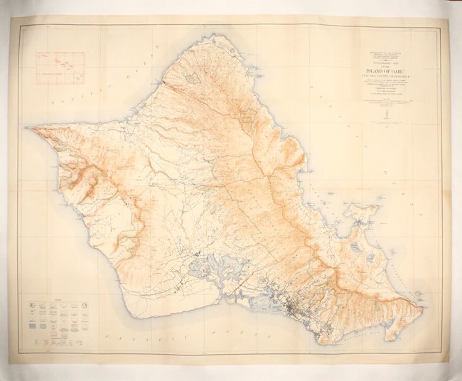
This large and precisely engraved map of the island of Oahu is based on surveys conducted by the Engineer Troops of the U.S. Army from 1909 to 1913. It is lithographed in four colors and drawn on a scale of one inch per mile with 40-foot contour intervals. The map features Honolulu in miniature plan form, but the main draw is the rich topographical detail. In addition to villages, roads, railroads, bridges, and dams, the legend at bottom left identifies Ahupuaa or land-grant lines, aqueduct tunnels, fresh and salt marshes, tidal flats, taro fields, sand dunes, and more. The legend also features a helpful key translating Hawaiian topographical terms. An inset at upper left illustrates The Hawaiian Islands. The map was prepared by the Geological Survey with the cooperation of W.F. Frear, Governor, and J.W. Caldwell, Supt. of Public Works.
References:
Condition: B+
Issued folding, now flattened and professionally mounted on canvas to repair fold separations, with light toning.