Subject: Los Angeles, California
Period: 1928-36 (dated)
Publication:
Color: Printed Color
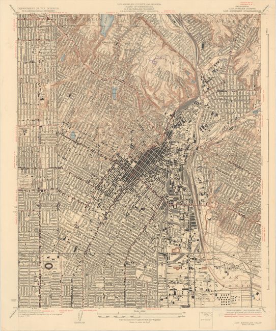
A. California (Los Angeles County) Los Angeles Quadrangle, by U.S. Geological Survey, dated 1928 (15.4 x 18.5"). A highly detailed map of downtown Los Angeles extending from Los Felis and San Rafael south to Exposition Park and San Antonio. Shows the major roads, railroads, and thousands of individual structures. Topography is depicted by tan contour lines and is concentrated to the north of the city around Elysian Park. Drawn on a detailed scale of nearly 3 inches per mile. Condition: There are pinholes in the sheet corners that just enter the image at top left. Old library stamp on verso. (B+)
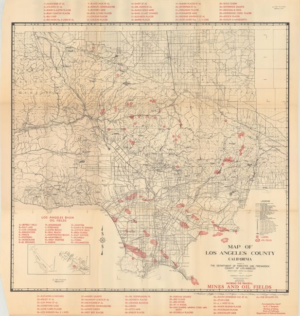
B. Map of Los Angeles County California, by the Department of Forester and Firewarden County of Los Angeles, dated 1936 (22.1 x 21.3"). A detailed map of Los Angeles county showing both mines and oil fields in the region. The mines are almost entirely located to the north of Pasadena in the Angeles National Forest while the oil fields are south of downtown. Includes two numbered keys and a small inset of Catalina Island. Condition: Issued folding on somewhat brittle paper with light toning along the folds and a number of fold separations that have been mostly closed on verso with archival tape. (B)
References:
Condition:
See description above.