Subject: San Francisco, California
Period: 1918 (dated)
Publication:
Color: Black & White
This lot features two maps of the San Francisco Bay that were published by the Board of State Harbor Commissioners:
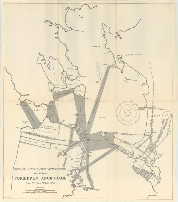
A. Board of State Harbor Commissioners Map Showing Forbidden Anchorage Bay of San Francisco, (14.3 x 16.4"). This map covers the northern San Francisco Bay, extending from the city east to Oakland, Berkeley and Richmond. The most prominent feature is the numerous zones in the Bay where anchoring is prohibited, including a large stretch between San Francisco and Oakland and at the Bay's entrance. Inland detail of the street-grid patterns are also shown. Lithographed by The Union Company in San Francisco.
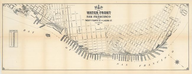
B. Map of the Water Front of San Francisco from Twenty Fourth St. to Laguna St., by A.B. Hosmer (41.5 x 14.9"). A detailed map depicting the city's piers from approximately Channel Street to Van Ness. Locates the Union Depot & Ferry House, a government reservation west of Van Ness, and Mission Rock. Lithographed by Olsen Company in San Francisco.
References:
Condition: A
Issued folding with just a hint of toning along the fold lines of the large map, otherwise fine.