Subject: Southern California
Period: 1915-16 (dated)
Publication:
Color: Black & White
This lot contains five early road maps of Southern California including:
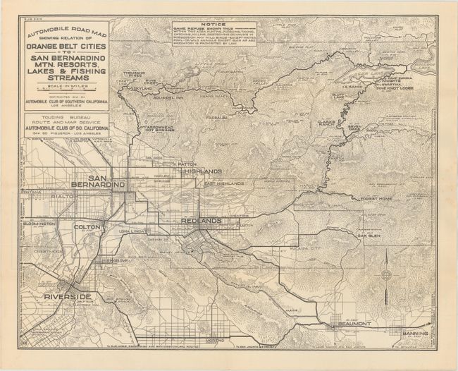
A. Automobile Road Map Showing Relation of Orange Belt Cities to San Bernadino Mtn. Resorts, Lakes & Fishing Streams, dated 1916 (17.5 x 14.0"). Covers the region from San Bernardino and Riverside east to Big Bear and Beaumont. Beyond the road system, the map provides good detail of topography, drainage, and points of interest.
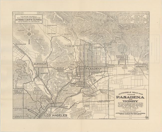
B. Automobile Road Map Touring Pasadena and Vicinity Showing Boulevard System to Los Angeles and Adjacent Cities Together with Principal Points of Interest to the Motoring Public, dated 1916 (14.3 x 11.4"). Extends from Los Angeles to Pasadena, Altadena, and Sierra Madre. Includes a numbered key to 12 points of interest in Pasadena.
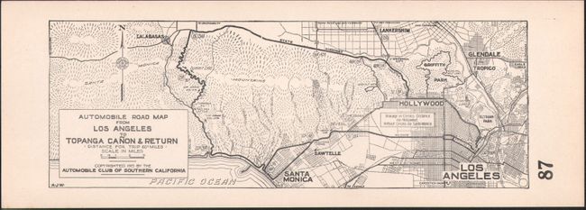
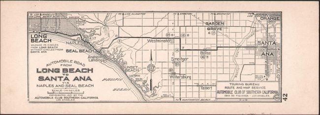
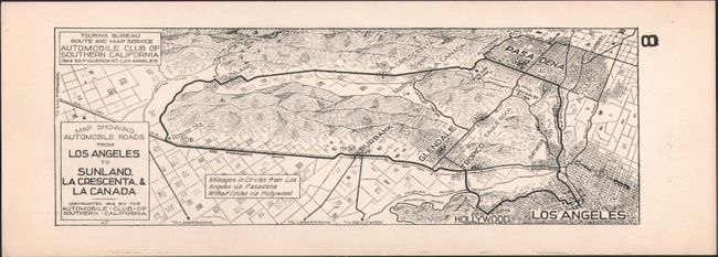
C. [Lot of 3] Automobile Road Map from Los Angeles to Topanga Canon & Return [and] Map Showing Automobile Roads from Los Angeles to Sunland. La Crescenta, & La Canada, [and] Automobile Road from Long Beach to Santa Ana Via Naples and Seal Beach, dated 1915-16 (8.6 x 3.0"). Three strip maps that detail round trips from Los Angeles and Long Beach with mileage noted along each route. These little maps were precursors to the famous TripTiks issued by its parent organization (AAA).
References:
Condition: A
Near fine with a hint of pleasant light toning.