Subject: Arizona
Period: 1885-1903 (circa)
Publication:
Color: Printed Color
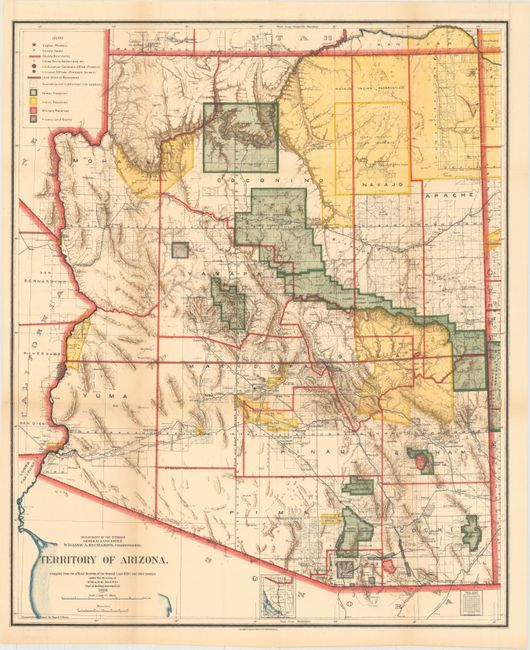
A. Territory of Arizona, by General Land Office, dated 1903 (16.9 x 20.6"). This is a colorful and fascinating map that carries detail of the territory just nine years before attaining statehood. The extent of nine Indian reservations and at least four Military reservations, including Fort Apache, are clearly shown in different colors. Private claims, confirmed and unconfirmed, are outlined in red. The Grand Canyon Forest Reserve is shown. Brown hachured mountainous areas and the blue waterways combine to provide great visual impact. Details include watershed, mountains, railroads, wagon roads, private claims, unsurveyed townships, etc. Of note, this is the first map to name Sedona, here called Sedonia. Condition: Issued folding with minor toning and a 1.5" fold separation at bottom left. (B+)
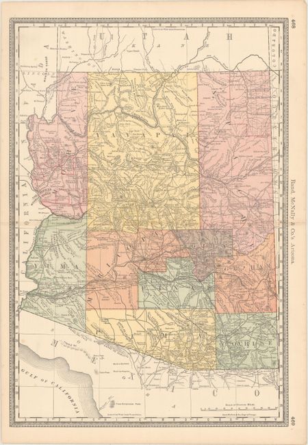
B. Rand, McNally & Co.'s Arizona, by Rand, McNally & Co., from Business Atlas, circa 1885 (13.2 x 19.3"). This detailed atlas map delineates counties, mountains, reservations, rivers, roads, towns, forts, springs, and more. Condition: There are a few minor, unobtrusive spots in map image. (A)
References:
Condition:
See description above.