Subject: Northwestern United States
Period: 1865 (dated)
Publication: Johnson’s New Illustrated (Steel Plate) Family Atlas
Color: Hand Color
Size:
23.3 x 16.9 inches
59.2 x 42.9 cm
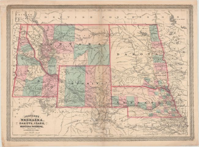
This handsome map is centered on the newly created Wyoming Territory (1868) which shows county development circa 1870, with Uinta, Sweetwater, Carbon, Albany and Laramie, but prior to the establishment of Yellowstone National Park in 1872. Montana is shown, which, along with Wyoming, was previously contained in a large Idaho territory. Idaho Territory has ten organized counties. In Montana Pompey's Pillar is located as are the forts of C.F. Smith, Sarpy, Galpin, and more. Gold deposits are noted in south central Montana above Yellowstone, which will not appear for three more years. Excellent detail throughout with scores of towns and villages named, trails, wagon roads, immigrant roads, railroads, forts and more. Topography is shown via hachure and watershed is well developed. Features Johnson's later border.
References:
Condition: B+
Light toning along the centerfold with repairs to several short separations and light soiling. Remargined at top to accommodate framing.