Catalog Archive
Auction 172, Lot 180

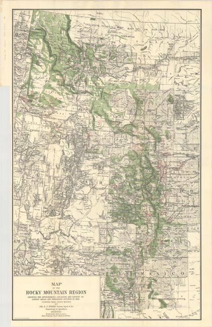
"Map of the Rocky Mountain Region Showing the Approximate Location and Extent of Forest Areas and Irrigation Ditches in 1885", U.S.D.A.

Subject: Western United States

Period: 1885 (circa)

Publication:

Color: Printed Color

Size:
18.9 x 30.9 inches
48 x 78.5 cm
Download High Resolution Image
(or just click on image to launch the Zoom viewer)

Uncommon map of the Intermountain West featuring forest lands shown in green and main irrigation canals shown with red overprinting. Stretches from Canada to Mexico and includes Idaho, Montana, Wyoming, Utah, Colorado and New Mexico with most of Arizona. Remarkable detail throughout including surveyed townships, towns, forts, Indian reservations, watershed, and topography by hachure. An important map documenting the canal and irrigation systems eventually created in the West. Finely lithographed by the firm of A. Hoen of Baltimore.

References:

Condition: A

Issued folding on a bright sheet with a binding trim at left.

Estimate: $90 - $120

Sold for: $85

Closed on 4/17/2019

Archived