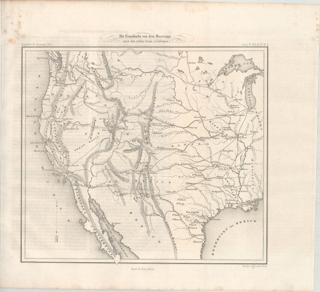
Subject: Western United States
Period: 1856 (dated)
Publication:
Color: Black & White
Size:
11.5 x 10.3 inches
29.2 x 26.2 cm
This map of the western United States was issued in Zeitschrift fur Bauwesen (a German construction magazine) to show the possible railroad routes to the Pacific Ocean. With the vast new territories acquired from Mexico along with the recent gold discoveries in California, interest in the American West had spread internationally. The 6 pages of text that accompanies the map states that the three most viable railroad routes were the northern route (St. Paul to Seattle), the central route (Council Bluffs to Benicia) and the southern route (Fulton, AR to San Pedro). The article contains a graph showing the lengths and cost of each line and some interesting observations including "over a thousand miles of this line lie in a completely depopulated country."
References:
Condition: A
The map is clean and crisp with a bit of foxing in the top left blank margin. Accompanying text also has minor foxing.