Subject: Central United States
Period: 1856 (published)
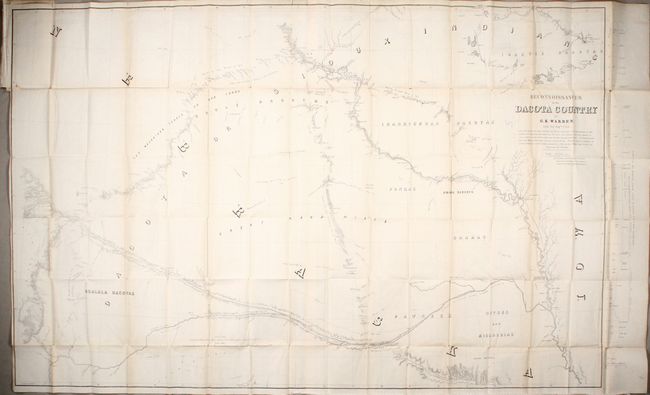
Publication: Explorations in the Dacota Country, in the Year 1855
Color: Black & White
Size:
57.9 x 36.2 inches
147.1 x 91.9 cm
This large map was printed on two sheets and joined. It covers the region from Omaha north to Fort Ridgley (MN) and west to Fort Laramie (WY). The path of Warren's exploration is traced throughout the region with encampment dates noted. The map also depicts previous explorers' routes including Long, Fremont, Stansbury, and Nicollet. It presents good detail of topography, the river systems, and the location of numerous Indian tribes and reserves.
Lieutenant G.K. Warren served as topographic engineer on the "Sioux Expedition" under the command of General William S. Harvey, who was sent to "chastise the Sioux for the killing of Lt. John L. Grattan and his command of twenty-nine men in the summer of 1853." Also providing a geological report, but not actually accompanying the expedition was F. V. Hayden, better known to the Indians from an earlier explorations as "Man Who Picks Up Stones Running" for his peculiar habit of gathering rock samples alone in hostile country (they thought he was crazy).
References: Howes #W-118; Wagner-Camp #283.
Condition: B+
Issued folding with light toning along the folds. There are several short separations along the folds and a binding trim with two associated 1" tears at top left.