Catalog Archive
Auction 172, Lot 160

"Sketch of the Country Embracing Several Routes from Portsmouth Ohio, to Linville, N.C and Exhibiting the Relative Positions of the Contemplated Road...", U.S. Corps of Engineers

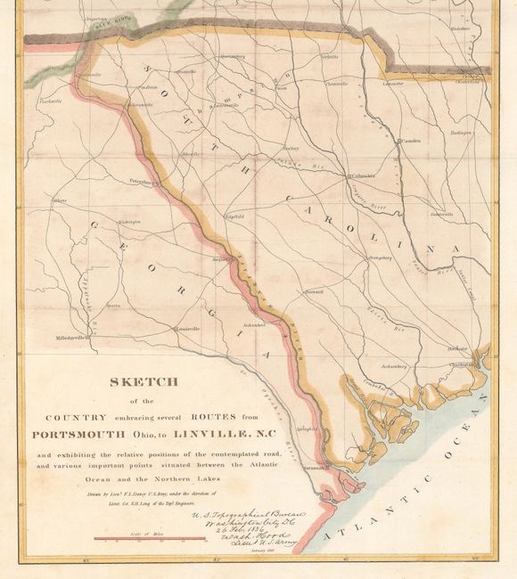
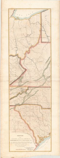
Subject: Central & Southeast United States

Period: 1836 (dated)

Publication: HR Doc. 169, 24th Congress, 1st Session

Color: Hand Color

Size:
12.1 x 40.9 inches
30.7 x 103.9 cm
Download High Resolution Image
(or just click on image to launch the Zoom viewer)

This map details the country between Lake Erie south to the Atlantic Ocean near Savannah. The route of the proposed road originates in Portsmouth on the Ohio River and meanders down through Kentucky, [now] West Virginia, Tennessee and to the vicinity of Morgantown in North Carolina. The National Road is shown running between Columbus and east to Brownsville, PA. The map locates Louisville, Sparta, Savannah, Charleston, Columbia, Parkersburg, Pittsburgh, Cleveland, and many more towns and cities. Important places like the Charleston Salt Works are also located. Drawn by Lieut. F.L. Darcy under the direction of Lieut. Col. S.H. Long, Topographical Engineers. Signed in the plate.

References:

Condition: B+

Issued folding with light scattered foxing and an edge tear confined to the bottom blank margin that has been closed on verso with archival tape.

Estimate: $160 - $190

Unsold

Closed on 4/17/2019

Archived