Subject: Colonial Southeast United States
Period: 1708-57 (circa)
Publication:
Color: Black & White
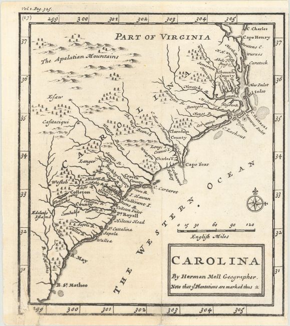
A. Carolina, by Herman Moll, circa 1708 (6.2 x 7.0"). This small, scarce map is derived from the important Gascoyne map of 1682. The map covers the coast from Cape Henry to B. St. Matheo with nice detail of the plantations, particularly in the vicinity of Charlestown. Five counties are named. This is the first state with page number located above the top left border. Reference: Cumming #148. Condition: A dark impression with a few worm tracks in the bottom left corner that have been repaired on verso with old paper, resulting in minor loss of border. (B+)
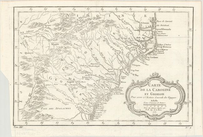
B. Carte de la Caroline et Georgie pour Servir a l'Histoire Generale des Voyages, by Jacques Nicolas Bellin, from Histoire Generale des Voyages, dated 1757 (11.2 x 7.4"). Delicately engraved map of the colonies of Carolina and Georgia from Albemarle Sound to the Alatamaha River. It probably owes its origin to the 1752 map of the region by Emanuel Bowen. There are numerous English settlements along the coast and Indian villages are located throughout, including a number west of the Appalachian Mountains. There is more detail in the area west of the Blue Ridge than in many other maps of the period. It shows a rudimentary course of the Tennessee River in the northwestern section of the map. A decorative rococo-style title cartouche incorporates the distance scale. References: Cumming (SE) #311; Sellers & van Ee #1384. Condition: A dark impression on a clean sheet with just a hint of offsetting. Issued folding. (A)
References:
Condition:
See description above.