Subject: Mid-Atlantic United States
Period: 1865 (dated)
Publication:
Color: Black & White
Size:
31.4 x 46.1 inches
79.8 x 117.1 cm
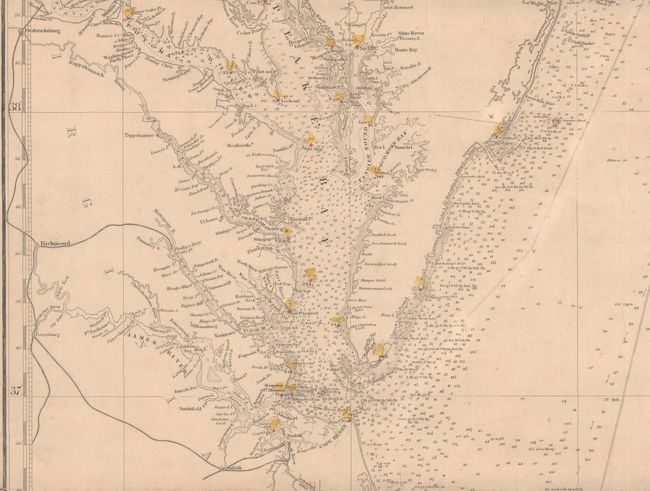
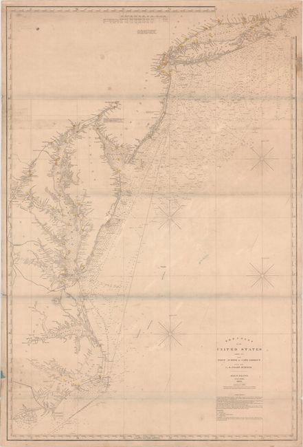
This large-scale blueback chart extends from Newport, Rhode Island to Cape Lookout, North Carolina. There is excellent navigational detail with hundreds of soundings, rocks, shoals, currents, and lighthouses. The Chesapeake Bay is will defined and the coastal detail includes major cities and inland waterways. Created in 1854 with additions to 1865. Backed with stiff blue paper and the original printed paper label on verso.
References:
Condition: B
This working chart is in good condition considering its heavy use, with light toning, moderate soiling, and a few pencil notations. There are a few minor tears and chips along the edges of the sheet, including one that has an old linen repair at top right, and some creases that appear to have been caused during the gluing of the chart onto the blue paper backing. There are horizontal grayish shadows along the folds that were caused by our scanner and do not appear on the chart itself.