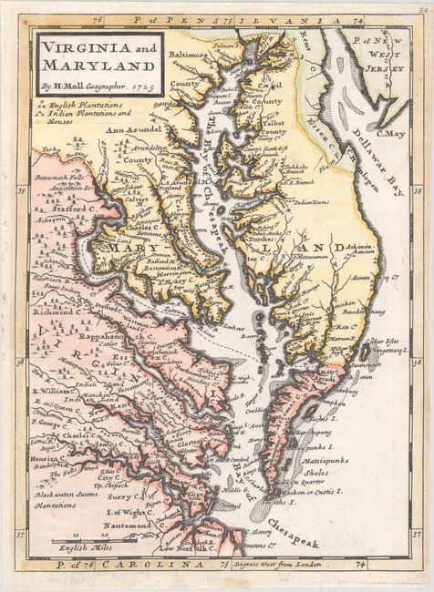
Subject: Colonial Mid-Atlantic United States
Period: 1729 (dated)
Publication: Atlas Minor
Color: Hand Color
Size:
7.8 x 10.6 inches
19.8 x 26.9 cm
This map of the eastern coast of Virginia, Maryland, and the Chesapeake Bay was based on Augustine Hermann's map of 1673. The map labels counties, towns, water ways, Indian lands, plantations, and provides useful notations such as "the swamp here not passable." A key under the title identifies English plantations and Indian plantations and houses. This map was first published in John Oldmixon's British Empire in America, and then appeared in Moll's Atlas Minor and Thomas Salmon's Modern History: or the Present State of All Nations.
References: Stephenson & McKee #II-16; Wooldridge #86; Shirley (BL Atlases) T.MOLL-9a #54.
Condition: A
A sharp impression on a clean, bright sheet of watermarked paper with minor marginal soiling.