Catalog Archive
Auction 172, Lot 133

"Carte de la Nouvelle Angleterre, Comprenant les Etats de Massachusets Bay, N. Hamp Shire, Connecticut et Rhode Island...", Brion de la Tour, Louis

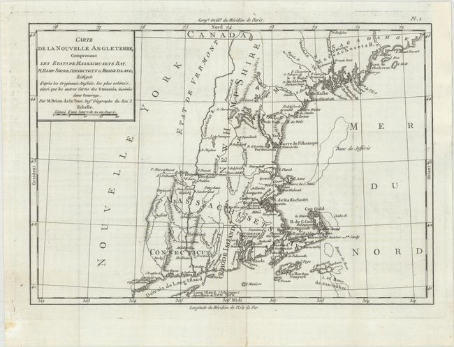
Subject: Colonial New England United States

Period: 1782 (published)

Publication: Essais Historiques et Politiques sur les Anglo-Americains

Color: Black & White

Size:
12.8 x 8.9 inches
32.5 x 22.6 cm
Download High Resolution Image
(or just click on image to launch the Zoom viewer)

This map appeared as plate 1 in Michel Rene Hilliard d'Auberteuil's Essais Historiques et Politiques. It covers the New England region from Long Island and Connecticut north to New Hampshire and Maine, here called Main Sagadahok. The map's primary emphasis is on the numerous forts in the area, with significant concentrations present in western Massachusetts and Maine. Basic topography and the river systems are also depicted.

References: Phillips (Maps) p. 472.

Condition: B+

A dark impression on a watermarked sheet with faint offsetting. A binder's trim at top right has been replaced with old paper and an associated short binding tear has been archivally repaired on verso.

Estimate: $250 - $325

Unsold

Closed on 4/17/2019

Archived