Subject: Eastern United States
Period: 1826 (published)
Publication: Storia della Guerra dell'Independenza degli Stati Uniti…
Color: Black & White
Size:
17.4 x 12.4 inches
44.2 x 31.5 cm
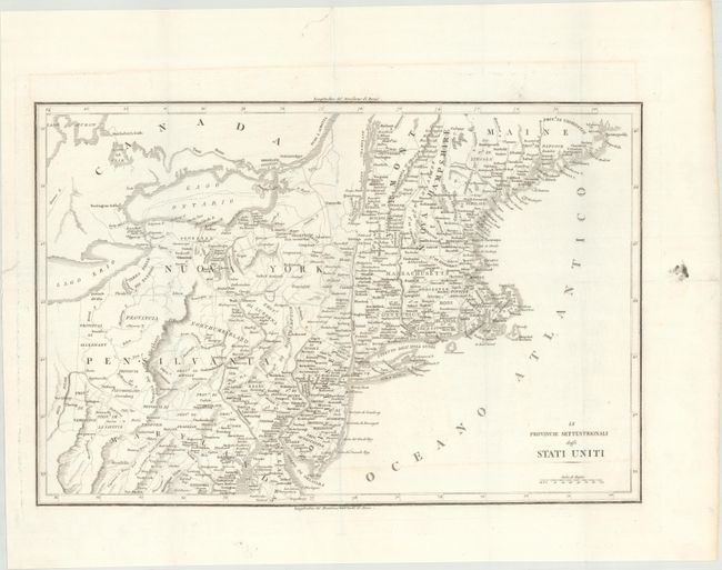
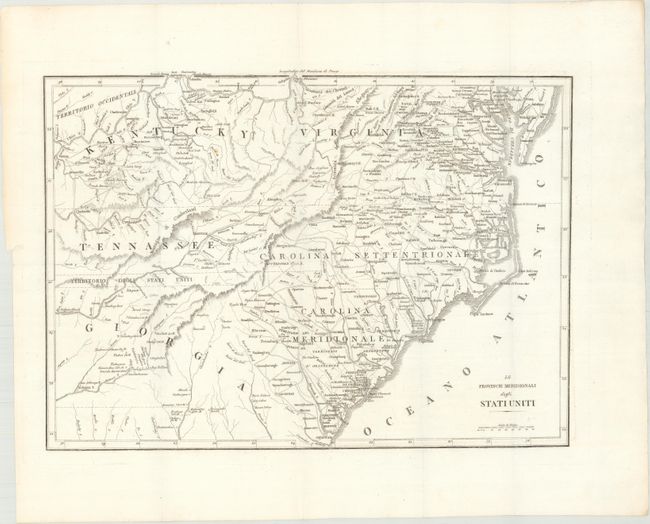
An uncommon pair of maps that were issued in Carlo Botta's Storia della Guerra dell'Independenza degli Stati Uniti. The northern map covers the area from Maine, south to Maryland, and west to the Ohio-Pennsylvania boundary. The map has good detail of the topography, watershed and settlements of the region. The southern sheet covers the states of Kentucky, Virginia, Tennessee, North and South Carolina and part of Georgia. It provides a good view of early settlements and roads, as well as the mountains, forests and Indian villages. Between Tennessee and Georgia is a long strip of land labeled Territorio degli Stati Uniti. This land originally belonged to South Carolina but was ceded back to the United States in 1787, subject to Indian occupancy. Numerous Indian villages are shown, especially in the region of present-day Alabama.
According to Howes, this volume, first published in 1809, was the "most valuable history of the Revolution up to its date."
References: Howes #B-636.
Condition: A
Issued folding on bright watermarked paper with wide margins. There are a few faint spots in the southern sheet and a printer's smudge in the right blank margin of the northern sheet.