Subject: Colonial Eastern United States
Period: 1757 (dated)
Publication: Histoire Generale des Voyages
Color: Black & White
Size:
11.9 x 8.6 inches
30.2 x 21.8 cm
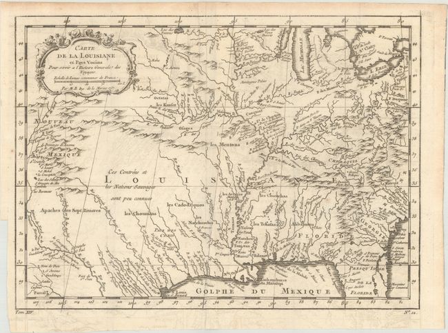
A. Carte de la Louisiane et Pays Voisins pour Servir a l'Histoire Generale des Voyages. Superb small map based on Delisle's map of the French colony of Louisiana. This finely engraved and detailed map of French Louisiana extends from the Great Lakes to the Gulf of Mexico and from Nouveau Mexique to Florida (not showing the tip of Florida). Many Indian place names, forts, and early European settlements are shown. Nouveau Mexique in the far west includes Santa Fe and names the S. Jerome de Taos. The decorative title cartouche includes the distance scale.
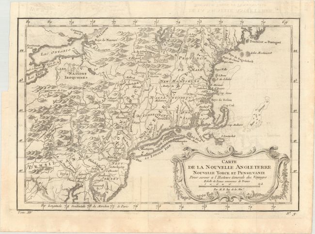
B. Carte de la Nouvelle Angleterre Nouvelle Yorck et Pensilvanie... This French & Indian War period map details the English colonies from Pennsylvania through to Castine, Maine, with their early boundaries. It is fully engraved with topographical features and includes many early place names. The colonies are shown confined east of the Allegheny Mountains with the Nations Iroquoises, Indian villages, and several French forts located west of the mountains. It extends to show Lake Ontario and most of Lake Erie. A flourishing French rococo-style cartouche with distance scale decorates the map. References: McCorkle #757.1; Sellers & Van Ee #721.
References:
Condition: B+
Issued folding with light offsetting.