Subject: Western Hemisphere - America
Period: 1795 (dated)
Publication:
Color: Hand Color
Size:
9.6 x 13.9 inches
24.4 x 35.3 cm
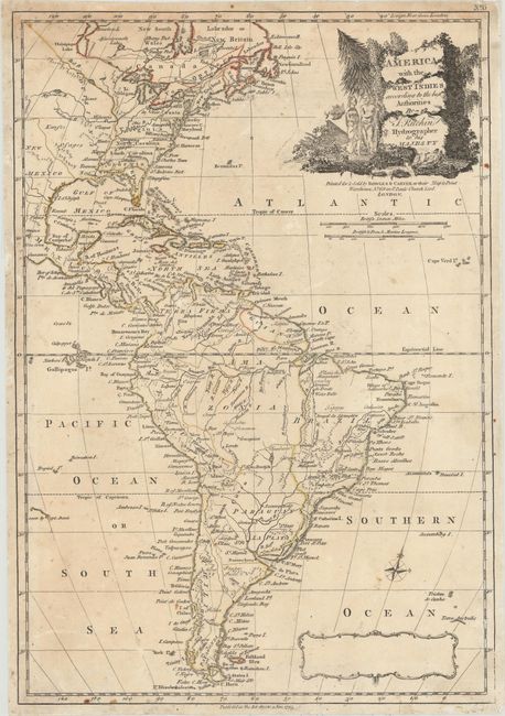
A scarce and delicately engraved map showing the eastern two-thirds of North America and all of South America. The United States western boundary is the Mississippi River with Georgia, South Carolina, North Carolina, and Virginia all reaching its edge. Virginia's footprint also includes all the land west of Pennsylvania and north of the Ohio River. The map is decorated by a title cartouche featuring two natives, flora, and an erupting volcano. Below the title cartouche is the imprint of Bowles & Carver with a 1795 date, however, Thomas Kitchin had died in 1784 suggesting this is a reissued plate. A blank cartouche at bottom that previously held either a key or dedication is further indication of a reissue. No other examples of this map have been listed in the last 35 years.
References:
Condition: B+
On a watermarked sheet with light toning and minor staining. There are a few small holes in the Atlantic Ocean that have been professionally infilled.