Subject: Western Hemisphere - America
Period: 1745 (dated)
Publication:
Color: Hand Color
Size:
24.3 x 19.3 inches
61.7 x 49 cm
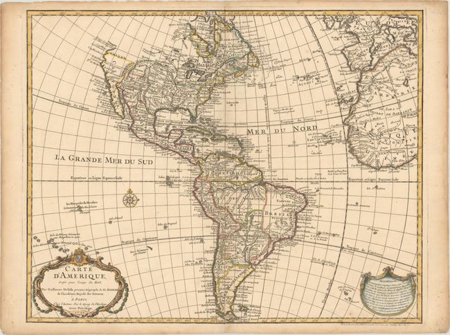
Guillaume Delisle's map of the Americas [1722] was one of the most popular maps of the 18th century with numerous editions. This is an unchanged reissue of the 1722 plate with Buache's imprint added at bottom right. This detailed map of the Americas provides a great deal of information about the state of geographic knowledge in the New World in the early part of the century. The French territory of Louisiane takes up the lion's share of North America at the expense of the British colonies. This political bias was due to Delisle's position as geographer to the King of France. In South America, a small Brazil adjoins the Pays des Amazones. A garland style title cartouche and another cartouche containing a note decorate the lower corners.
References: Tooley (Amer) p. 13, #5.
Condition: B+
On a watermarked sheet with a few spots of foxing and short centerfold separations at top and bottom that have been archivally repaired. Light toning along the sheet edges.