Subject: Africa
Period: 1720 (circa)
Publication:
Color: Hand Color
Size:
22.4 x 19.1 inches
56.9 x 48.5 cm
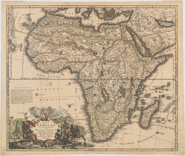
Handsome, large map of the continent with the typical inaccuracies of eighteenth century cartography. The map conforms to the twin lake configuration for the source of the Nile and a lengthy paragraph on the map purports to provide evidence of the accuracy of this theory based on the work of Heinrich Scherer. The geographical features are identical to the map that Johann engraved for Jacob von Sandrart, circa 1697, prior to Homann establishing his own publishing firm. The political boundaries and the large title cartouche are different. The cartouche is filled with interesting imagery including the pyramids, ivory trading, the source of the Nile, a troop of monkeys (throwing rocks at their hunters), kings, chiefs and warriors, a fat-tailed sheep with its tail supported by a wagon, and cherubs bringing salvation to the continent.
References: Norwich #72.
Condition: B+
A crisp, dark impression with contemporary color, minor soiling, and a short centerfold separation at bottom that has been closed on verso with archival tape. There are small remnants of hinge tape on verso.