Subject: Eastern India
Period: 1753-80 (circa)
Publication:
Color: Black & White
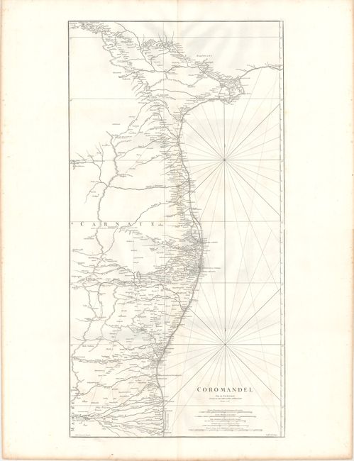
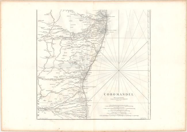
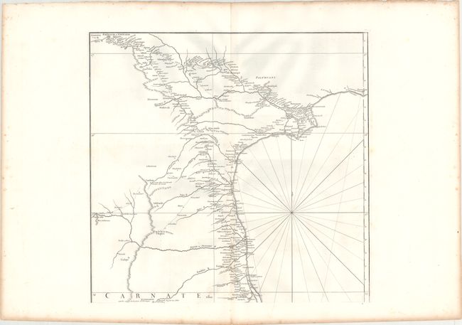
A. [On 2 Sheets] Coromandel, by Jean Baptiste Bourguignon d'Anville, dated 1753 (19.7 x 18.9"). This two-sheet map of the Coromandel Coast extends from Nega-Patnam (Nagappattinam) to Masuli-Patnam (Machilipatnam). The map gives good detail of the towns, rivers, mountains, and routes between towns, and even identifies Shutri, resting places for travelers. Engraved by Guillaume Delahaye. Condition: Wide margins on bright paper with a few faint spots and light toning in far blank margins. Please note that the first image is a composite image - the map is on two separate sheets.
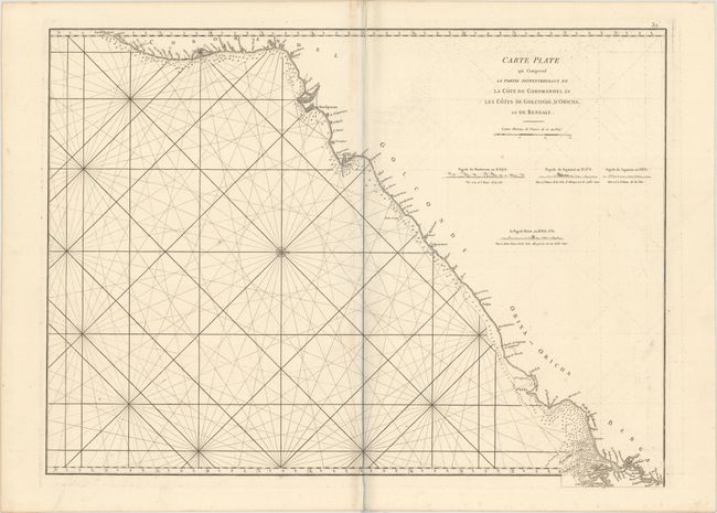
B. Carte Plate qui Comprend la Partie Septentrionale de la Cote de Coromandel et les Cotes de Golconde, d'Oricha, et de Bengale, by Jean Apres de Mannevillette, circa 1780 (26.3 x 19.5"). This sea chart of the eastern coast of India extends from just south of Madras (Chennai) to Calcutta (Kolkata). Oriented with north to the right, the coastline is filled with soundings and navigation hazards. Four coastal views are depicted in the interior of India. Condition: A fine impression on sturdy, watermarked paper with light offsetting and a few faint spots.
References:
Condition: A
See description.