Subject: India
Period: 1861 (dated)
Publication:
Color: Hand Color
Size:
32.6 x 19.3 inches
82.8 x 49 cm
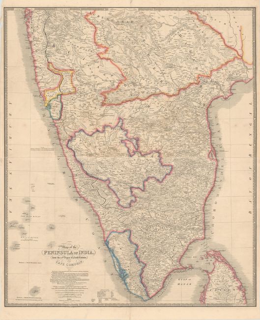
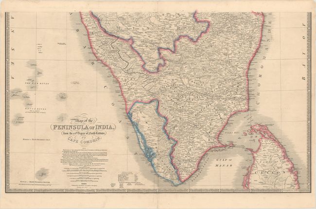
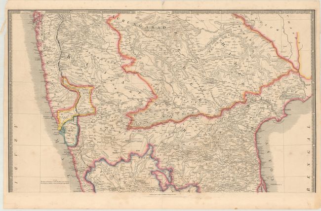
This impressive map was issued shortly after the creation of the British Raj (1858), when power transferred from the British East India Company to the Crown. Printed on two large sheets, the map covers the Indian subcontinent from Bombay (Mumbai) and Aurungabad, south to include the northern half of Sri Lanka (Ceylon). Original outline color indicates British Possessions, the Rajah of Mysore, the Marhatta Countries, the Nizam's Dominions, the Rajah of Sittarra, and the Travancore. The dimensions given are for each sheet; if joined, the map would measure 32.6 x 38.6".
James Wyld was successor to William Faden, one of the luminaries of late eighteenth century publishing in England. Wyld maintained the high standard of graphic and factual excellence that had been established by his predecessor and his maps are among the finest published in the early nineteenth century.
References:
Condition: B+
There is light scattered foxing and faint offsetting. The bottom sheet has centerfold separations at top and bottom that just enter the image. Please note that the first image is a composite image - the map is on two separate sheets.