Subject: Southern China
Period: 1655 (published)
Publication: Novus Atlas Sinensis
Color: Hand Color
Size:
19.2 x 15.9 inches
48.8 x 40.4 cm
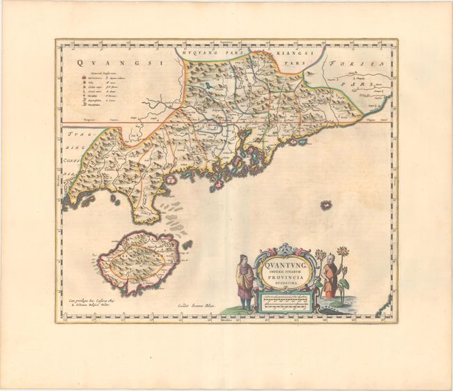
Based on the remarkably accurate compilations of the Jesuit Father Martino Martini during his travels between 1643 and 1650, this map depicts the province of Guangdong (Quantung), on the southern shore of China, and extending to include Hainan. A legend at left identifies cities and towns of various sizes, forts, and mines for silver and lead. The mouth to the Pearl River is dotted with islands, including Macao and the islands that would eventually become Hong Kong. The important city of Guangzhou (Canton) is shown a little further north. The map is embellished with a strapwork cartouche flanked by Chinese figures and lotus flowers. Blank verso.
References: Van der Krogt (Vol. I) #8432:2.
Condition: B+
A crisp impression with lovely old color on paper with a large wreath watermark. There is light printer's ink residue and minor offsetting. Very nearly an "A" example.