Catalog Archive
Auction 171, Lot 645

"A Map of the Land of Promise Compiled Out of the Book of Joshua", Anon.
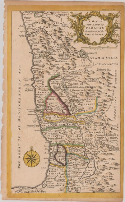
Subject: Holy Land

Period: 1760 (circa)

Publication:

Color: Hand Color

Size:
8.4 x 14 inches
21.3 x 35.6 cm
Download High Resolution Image
(or just click on image to launch the Zoom viewer)

An uncommon English map of the Holy Land showing the twelve tribes of Israel on both sides of the Jordan River. It covers the region from the Orontes River in Syria south to the Nile River in Egypt, with settlements, topography, and forests drawn pictorially. Decorated by an ornate title cartouche and compass rose with fleur-de-lis. Marked "Plate.23.No. XI." at top right above the neatline.

References:

Condition: B+

There is light scattered foxing and a faint extraneous crease across the middle of the map image.

Estimate: $120 - $150

Sold for: $50

Closed on 2/6/2019

Archived