Subject: Malta
Period: 1680 (circa)
Publication:
Color: Hand Color
Size:
21.3 x 17.3 inches
54.1 x 43.9 cm
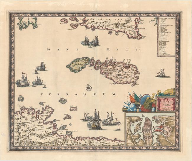
This superb map shows the strategic location of Malta between Sicily and the northern coast of Africa where the fortified cities of Tunis and Tripoli are highlighted. A large inset shows the extensive fortifications of Valleta that were built by the famous Knights of Malta after the Siege of Malta. Three sea battles are depicted in the Mediterranean and a key identifies the important sites. The title cartouche is festooned with implements of war and a beautiful, picture-frame style border encloses the map.
References:
Condition: A
A strong impression with striking color with gilt highlights. There is very faint toning, a tiny hole in the top border of the inset, and professionally repaired centerfold separations at top and bottom that just enter the map border. There are some abrasions and a short tear confined to the blank margins.