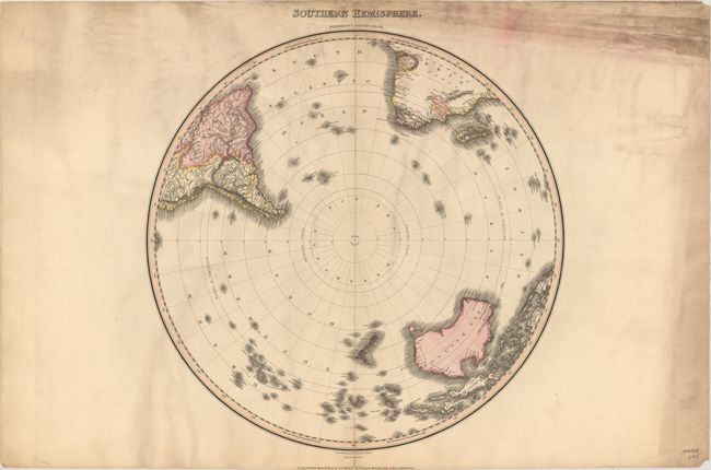
Subject: South Pole
Period: 1812 (dated)
Publication: Pinkerton's Modern Atlas
Color: Hand Color
Size:
19.7 x 19.9 inches
50 x 50.5 cm
This striking map shows all of New Zealand, New Holland (Australia), Papua New Guinea, and Madagascar. It extends north to the Equator, showing the Amazon River in South America and above the Congo region in Africa. The Antarctic region is completely blank with the Lord Aucklands Group depicted as the southernmost islands. Drawn by L. Hebert and engraved by Neele. Published by Cadell & Davies and Longman, Hurst, Rees, Orme & Brown.
References:
Condition: B
There are short edge tears and separations, including a 3" centerfold separation at bottom, that have been closed on verso with tape. Moderate soiling is mostly concentrated in the blank margins.